Книги о Путешествиях
Различные книги в жанре Книги о ПутешествияхTrekking Munich to Venice

This guidebook describes the 570km (354 mile) Traumpfad or 'Dream Way', an Alpine trek from Munich's Mariënplatz to the Piazza San Marco in Venice. The route is broken into 30 stages of between 5hrs 30mins and 9hrs, graded according to difficulty, with 5 alternative stages and the option to spend a day traversing a section of via ferrata in the Dolomites. Previous experience of Alpine trekking is not necessary as the route is suitable for most able walkers: however, a head for heights is essential.
Known as 'Europe's playground', the Alps boast an unrivalled walking infrastructure and breath-taking views of angular peaks, flower-strewn valleys and verdant slopes. Hugely popular with German trekkers but little-known in the English-speaking world, Der Traumpfad revels in this stunning scenery. The route passes through German Bavaria then Austria before entering the Italian Tyrol, taking advantage of the region's extensive network of mountain huts for accommodation en route.
With custom-designed mapping and stunning colour photography, the guide has all you need to get the best from your trek. Alongside detailed route descriptions, there is useful practical advice on when to go, what to take and refreshment stops, background information on the region's fascinating history, plants and wildlife and full contact details for over 80 places to stay. The result is an ideal companion to discovering this amazing route, regarded by many German trekkers as 'the hiking experience of a lifetime'.
The Westweg

This guidebook is all you need to discover The Westweg, a 285km walk along the length Germany's Black Forest from Pforzheim to Basel. This classic long-distance trail takes around two weeks to walk, in stages of 15-28km. The route is well way-marked and suitable for experienced hikers and those new to long distance walking, though some sections are steep.
Detailed descriptions and 1:100,000 maps accompany each stage of the route and the book describes options for shortening stages using public transport. There is also information on when to go, where to stay and a German-English glossary. With well-maintained and waymarked trails, an efficient public transport system and conveniently placed huts and farmhouse inns, the Black Forest is one of Germany's best-loved walking destinations.
The Westweg incorporates many of the region's highlights, such the Schwarzwald National Park, the source of the Danube and Lake Titisee. At Titisee there is a choice to make: the western route taking in the Black Forest's highest peak Feldberg and the vineyards of the Markgraflerland, or the quieter eastern route via the Herzogenhorn peak and on to Basel, with all its cultural attractions and old-world charm.
Walking in the Pentland Hills

This guidebook describes 30 circular walks in Scotland's Pentland Hills, a range of low summits which extends between Edinburgh and Biggar in South Lanarkshire. Ranging from 3 to 27km (2-17 miles), there is something to suit all abilities from the novice to the experienced hill-walker, with each route showcasing a different aspect of the area's unique character.
Step-by-step route description is accompanied by 1:50,000 OS mapping and a wealth of interesting information on the region's rich natural and cultural heritage: its geology, history, wildlife and connections with literary greats such as Robert Louis Stevenson and Sir Walter Scott. Local place names are explained, local folklore explored and there is a helpful glossary of dialect terms.
The Pentland Hills can be enjoyed in all seasons. Although the highest summit, Scald Law, stands at 579m, stunning vistas belie their modest elevation: this is a region of grass and heather-clad slopes which rise above picturesque valleys hiding streams and reservoirs. Walking in the Pentland Hills is an ideal companion to discovering great walking on Scotland's most accessible hills.
The GR10 Trail

Guidebook to the GR10, a 955km trek across the French Pyrenees from Hendaye on the Atlantic Coast to the Mediterranean coast at Banyuls-sur-Mer. Described in 55-day stages of 7-27km, the route can be completed in its entirety, usually in around 45 days, or in shorter sections using the bus and rail links found throughout the Pyrenees.
Step by step route descriptions are accompanied by 1:100,000 mapping and gradient profiles. Useful practical information is also included such as when to go, getting there and back, camping, accessing fuel and water, plus handy equipment tips and more.
The easiest, oldest and most popular of the three long-distance routes that traverse the mountain range, the GR10 is well waymarked and follows good mountain paths. For many walkers, the highlight of the route is the magnificent wildflowers and associated butterflies. For others, it's the spectacular mountain terrain, while those keen on bird watching will delight in scanning the sky for the many varieties of birds of prey that can be seen in the region, from the massive Griffon vulture to the distinctly coloured Egyptian vulture.
The River Rhone Cycle Route

Guidebook to The River Rhone Cycle Route, an 895km bicycle ride starting high in the Alps of central Switzerland and finishing at the Mediterranean Sea, near Marseille. The route – which is mostly downhill – is divided into 20 stages (averaging 45km per stage) and can be completed by most cyclists in 12-14 days.
The described route uses two waymarked national cycle trails: the Swiss R1 Rhone Route and the French ViaRhona, which together have been adopted by the ECF (European Cyclists' Federation) as EuroVelo route EV17.
The guide provides detailed route descriptions and 1:150,000 mapping for each stage, together with plenty of practical advice such as preparing for the journey, transport options there and back, what to take, accommodation en route and more. A Swiss/French glossary is also included.
The Pennine Way - the Path, the People, the Journey

This book presents a portrait of the Pennine Way, Britain's oldest and best known long-distance footpath, tracing its remarkable history through the experiences of walkers past and present. As Andrew McCloy walks the 268-mile route from the Derbyshire Peak District to the Scottish borders, he discovers how the Pennine Way set a benchmark for personal challenge and adventure and how reconnecting with wild places and the unhurried rhythm of the long walk continue to provide a much-needed antidote to our busy modern age.
The resilience of the long distance walker is mirrored in the path's fascinating history: the initial struggle for access, battles to tame the bogs, later challenges of path erosion and the fluctuating circumstances of the rural hostel. Above all else however this is a book about Pennine Way people – from crusading ramblers to resourceful B&B landladies, hard working rangers to fanatical trail walkers. Their conversations and memories are woven into the narrative to give an account of the changing fortunes of the path and its special significance.
Personal, thoughtful and often humorous, The Pennine Way – the Path, the People, the Journey is an exploration of our desire for challenge and adventure, the stimulation of wild places and how a long journey on foot through our own country still resonates today. It will appeal to people who have walked or are preparing to walk the Pennine Way, as well as to those with an interest in the history and legacy of this iconic path.
Walking in Austria

A comprehensive guidebook detailing walking routes in Austria. The 101 walks reflect the diversity of this popular region and cover Austria's magnificent Alps – including the Rätikon, Silvretta, Stubai and Zillertal – as well as the Dachsteingebirge, Hohe Tauern and the Karawanken. Graded according to difficulty and ranging from short walks of a few kilometres to day hikes and multi-day hut-to-hut tours, from the classic to the lesser-known, there is something to suit every level of ability and ambition.
A full description of each route is accompanied by clear sketch maps. This book has all the information you need to make the most of an active walking holiday in Austria, including information on public transport, accommodation, gear required and safety issues, full details of over 100 mountain huts and a German-English glossary.
Austria is one of Europe's most walker-friendly countries. Its 40,000km of well-maintained and waymarked trails pass more than a thousand Austrian mountain huts and countless attractive villages, hospitable hotels, inns and restaurants. It also boasts an extensive, integrated public transport system that is particularly useful for walkers.
Walking in the North Pennines
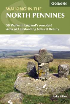
A guidebook to day walks in the North Pennines Area of Outstanding Natural Beauty (AONB), across Cumbria, County Durham and Northumberland. The book includes 50 walks exploring England's 'last wilderness', ranging from 5 miles (8km) to 14 miles (23km). The walks, which work well from bases such as Hexham, Barnard Castle, Alston, Kirkby Stephen and Appleby are mostly circular, with a smaller selection of linear routes, and there is something to suit all abilities over a variety of terrain.
Route descriptions are illustrated with OS 1:50,000 mapping and colour photographs, and the book includes details of local transport services, accommodation and tourist information centres. The walks cover a variety of terrain, from flat railway trackbeds to pathless moorland, and provide the opportunity to explore the striking geological features and fascinating industrial heritage of the area.
Walks in the South Downs National Park

Guidebook to 40 day walks in the South Downs National Park. The walks, which are designed to suit all abilities, are dotted all over the National Park and range from 4 miles (7.5km) to 11 miles (17.5km). Each walk is circular, and where possible begins and ends at a place accessible by public transport.
With some of the most iconic landscapes in southern England, including the white chalk cliffs of Beachy Head and the Seven Sisters, and such well-loved landmarks as Ditchling Beacon and atmospheric ancient monuments like the Cissbury Ring, walking in the park proves a delightful experience mile after mile.
Step-by-step route descriptions are accompanied by 1:50,000 OS mapping. Also included is information on the plants and wildlife of the Downs, as well as handy practical tips on accommodation, car parking and public transport.
The Danube Cycleway Volume 2

This guide describes the second part of the Danube Cycle route, a 1717km cycle ride following the lower part of the Danube from the Hungarian capital of Budapest through Hungary, Croatia, Serbia and Romania to the river's delta on the shores of the Black Sea.
The cycling is generally level with a few gentle gradients, mostly on quiet country roads or riverside flood dykes. The 32 stages vary from 30-100km, with some longer excursions and surfaces are mostly asphalt and in good condition, suitable for hybrid or touring cycles.
Cycling infrastructure is generally good in Hungary, Croatia and Serbia. In Romania, where there is no waymarking and often long distances between places to sleep and eat, this guidebook gives a detailed route description, maps for each stage at a cycle-friendly a scale of approximately 1:150,000 and a listing of all places offering accommodation. Off-route excursions enable short visits to be made to Bulgaria, Moldova, Ukraine and the Danube delta.