Книги о Путешествиях
Различные книги в жанре Книги о ПутешествияхWalking in Kent

Walking in Kent describes 40 circular day walks in the Garden of England. This guidebook includes routes ranging from 5 to 9 miles in west Kent and The Weald and north and east Kent. Encompassing woodland walks, clifftop paths and riverside rambles, there is something for everyone.
The guide includes easy-to-follow route descriptions, 1:50K OS map extracts, background information and a route summary table. It also gives outlines of 11 longer walks in the Kent area, including the Darent Valley Way, the Saxon Shore Way and the North Downs Way National Trail. Kent is a wonderfully diverse county and these walks explore every corner, from the estuaries of the Medway and to the vast sweep of the Weald with its historic villages, orchards, hop gardens and vineyards. But best of all, there is the surprise of long unhindered views and big skies over Kent, where Britain begins.
The Pennine Way
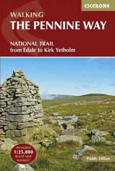
The Pennine Way is Britain's oldest, toughest long-distance footpath – and arguably its most iconic. Now a National Trail, the 427km (265½ mile) route from Edale in Derbyshire to Kirk Yetholm in the Scottish Borders offers wayfarers the opportunity to immerse themselves in wild beauty of the North. The Pennines boast rolling hills, sweeping moorland and wide glacial valleys, and the Pennine Way has come to embody personal challenge and adventure.
This guidebook presents the route in 20 daily stages of 10.5-31.5km (6½-19½ miles). Step-by-step route description is accompanied by 1:100,000 mapping and information about points of interest along the way, as well as advice on facilities and planning your trip, tips for walking the route and an alternative 15-day itinerary. Useful contacts and full accommodation listings can be found in the appendices. In addition, the guide includes a pocket-sized map booklet containing all the OS 1:25,000 mapping needed to complete the trail, saving the need to carry numerous map sheets.
The Pennine Way crosses three National Parks – the Peak District, Yorkshire Dales and Northumberland National Park – and other highlights include Cross Fell, the highest point in England outside of the Lake District; the Cheviot Hills; Kinder Scout; the limestone cliffs of Malham Cove; the North Pennines Area of Outstanding Natural Beauty and the awe-inspiring UNESCO World Heritage Site of Hadrian's Wall. Overnight options range from camping to a mixture of hostels and B&Bs and there is great camaraderie amongst wayfarers. With a wealth of information to help you get the most from your trip, Paddy Dillon's guide is an ideal companion to discovering this classic trail.
The High Tatras

With breathtaking scenery, some 600km of well-maintained, waymarked paths and a selection of characterful resorts, the Tatras mountains have all the elements of a perfect walking holiday. Straddling the border between Slovakia and Poland, the region boasts stunning mountain landscapes: rocky pinnacles, craggy peaks, jagged ridges and towering cliffs, mirror-surfaced tarns and dancing waterfalls.
Covering the Western, High and White Tatras, and both sides of the Polish-Slovakian border, it presents 180 walks and scrambles routes of between 1km and 30km (both circular and linear and from easy to strenuous) linking the main resorts with peaks, lakes and mountain chalets. In Poland, there is just one base – delightful Zakopane – whereas in Slovakia, you can walk from several villages strung out along the foot of the range and linked by a tramway. The guide also includes a wealth of information about local services, facilities and attractions and extensive practical advice covering travel and insurance, accommodation and facilities, mountain guides, languages and safety in the mountains. The Tatras have been designated as a UNESCO World Biosphere Reserve in recognition of their rich biodiversity and the guide presents a summary of the region's plants and wildlife, as well as its fascinating history. Other highlights include an ascent of Krivan, the national symbol of Slovakia, glorious ridge walks in the Western Tatras and gentler strolls taking in caves and waterfalls. Blending information with inspiration, this book is a must for anyone wishing to visit the High Tatras.
Walking the Lake District Fells - Patterdale

This guide describes ascents of 35 Lake District fells that can be climbed from Patterdale, Ambleside and the Grasmere, Thirlmere and Ullswater valleys. The area is home to some of Lakeland's most celebrated peaks – including the mighty Helvellyn, commanding over the classic arête scrambles of Striding Edge and Swirral Edge – with many summits connected by airy ridges affording great views and highly pleasurable walking.
Unlike other guidebooks which describe a single or limited number of routes to a particular destination, the aim of the Walking the Lake District Fells series is to offer all the options. These are presented as numbered sections which can be combined to create infinite possibilities – from simple ascents to longer ridge routes. You'll find the classics and popular routes alongside less traditional alternatives perfect for the wandering spirit. The series gives you both the freedom to devise your own routes and the information to make informed decisions, thanks to the clear descriptions of the routes, terrain, hazards, interesting features and safe descent paths should the weather close in. Also included are a handful of classic ridge routes for longer fell days. Mark Richards' inimitable text is complemented by HARVEY mapping and the author's own beautiful sketch topos and panoramas. Perfect for keen hillwalkers and peak-baggers alike and ideal both for pre-planning and use on the hill, Walking the Lake District Fells is the new incarnation of the Fellranger series, which sees the volumes updated and trimmed to a more practical size. These true connoisseurs' guides are sure to inspire you to get out and explore the beautiful fells of Lakeland.
For those collecting fell summits, a 'Fellrangers' hill list register can be found on the Long Distance Walkers Association website.
Backpacking Arizona

The world-famous Grand Canyon is only one of Arizona's spectacular natural features. Arizona encompasses over 90 wilderness areas, more than 15 national parks and monuments, and the largest national forest in the country. Expansive mesas, high peaks, and snaking canyons create a dynamic landscape and reflect a rich geologic and human history. Backpacking Arizona is the only guide devoted to overnight trips in the state. You'll discover the maze of side canyons and hidden grottos in the Grand Canyon's untrammeled backcountry, historic pioneer trails on the Mogollon Rim, the little-traveled Blue Range, and the legendary Superstition Mountains in the Sonoran Desert.

Rail-Trails Pennsylvania

Popular, proven format: Rail-Trails Pennsylvania, New Jersey and New York (9780899976495) sold 10,000 copies, strong numbers for a region-specific title Official guide from the Rails-to-Trails Conservancy 60 of the best rail-trails and multiuse pathways across Pennsylvania Fully updated book now split into two editions New edition in full color, with plenty of photographs Detailed maps for each trail, plus driving directions to trailheads Icons indicating the activities each trail can accommodate Succinct descriptions written by rail-trail experts
Rail-Trails New Jersey & New York

Explore 50 of the best rail-trails and multiuse pathways with this official guide All across the country, unused railroad corridors have been converted into public multiuse trails. Here, the experts from Rails-to-Trails Conservancy present the best of these rail-trails—as well as other multiuse pathways—in New Jersey and New York. You’ll appreciate the detailed maps for each trail, plus driving directions to trailheads. Quick, at-a-glance icons indicate which activities each trail can accommodate, from biking to fishing to snowmobiling. Best of all, the succinct descriptions are written by rail-trail experts, so you know it’s information that you can rely on! Many rail-trails are paved and connect communities, such as New Jersey’s 6.5-mile Pleasantville to Somers Point Bike Path. Some feature dramatic scenery, like the Ken Lockwood Gorge on New Jersey’s 11.3-mile Columbia Trail or the ultra-urban, lower Manhattan views from New York’s elevated High Line. Whether you’re on feet, wheels, or skis, you’ll love the variety in this collection of multiuse trails—from beautiful waterways and scenic areas to the hustle and bustle of the states’ urban centers!
Tour of the Jungfrau Region

This guidebook describes a 111km circuit amid some of the most spectacular mountain scenery in all the Swiss Alps. The Tour of the Jungfrau Region is described as a clockwise hut-to-hut circuit, beginning at Schynige Platte and ending at Wilderswil, broken into 10 stages (with a number of high and low- level alternatives offered). The route is suitable for hikers with some alpine experience.
The 111km trek takes you in a horseshoe loop through the Bernese Oberland's most spectacular mountain scenery, in the shadow of such iconic peaks as Wetterhorn, Eiger, Monch and Jungfrau. In a journey of 9 to 10 days the Tour visits pastures, ridges, summits and passes, skirts exquisite mountain lakes and gazes on waterfalls, gorges and glaciers. The guide contains all the information needed, including a trek planner, maps and profiles. On practically every stage modestly priced dormitories are available and, as meals are provided everywhere, walkers can trek unencumbered by heavy rucksacks.
Walking in Northumberland

The book comprises 36 short walking routes between 4 and 14 miles in Northumberland, England's most sparsely populated county. Ranging from easy ambles and gentle woodland trails to long days on the hills, there is something for all types of walker – and all types of weather. Taking in the beautiful coast with its immense, empty beaches and dramatic crag-top castles to the remote hills of the Cheviots and Pennines, the whole county is covered. Most of the routes are circular, but there are a few linear walks that make use of local bus services. The landscapes are rich in history, featuring Hadrian's Wall, Lindisfarne Priory, Bamburgh and Dunstanburgh castles, and much more. The walks are divided into five geographical areas: north-east Northumberland, National Park (north), Kielder, Tyne Valley and National Park (south) and the North Pennines. Each walk description contains information on start/finish points, distance covered, total ascent, terrain, approximate walking time, grade, maps required, transport options, public toilets and refreshments, and is accompanied by 1:50k OS mapping. The book also includes a handy route summary table.