География
Различные книги в жанре ГеографияA Field Guide to British Rivers
Temperate rivers are influenced by many factors including geology, climate, soils, sediment type, flow, as well as human activity. The complex interactions of the non-anthropogenic controlling factors have led to a wonderful diversity of river type throughout the British Isles. Sadly, almost all rivers in the UK have suffered significant and long-lasting modification by unsympathetic management, that has all but destroyed this variety, creating watercourses that are simplified conduits for water and sediment, designed primarily to drain the land and reduce flood risk. This volume aims to help reverse this, illustrating using over 200 images and descriptions, this variety of rivers in Britain, highlighting the many forms that temperate river systems take and providing an accessible summary of the underlying river science knowledge base. A Field Guide to British Rivers covers the full range of upland and lowland channel types and describes the full variety of substrate conditions from bedrock through boulder, cobble and gravel, to silt dominated systems. The authors describe examples gathered from their extensive research and practical experience working with rivers throughout mainland Britain and set those examples in their wider landscape context to exemplify the natural functioning of temperate river types. This book offers a practical and contextualised guide to contribute to efforts towards the sympathetic and sustainable restoration and re-naturalisation of degraded channels in the UK. Offering a unique viewpoint of both the underpinning science and the practicalities of river management, A Field Guide to British Rivers is an essential a stand-alone guide for anyone involved in river restoration and management as well as for those simply interested in rivers in general. Written as a field guide to demonstrate practical examples of river types, and to highlight the pressures they experience and their often-parlous condition, this book is intended to better inform both river management approaches and the policy necessary to achieve this. Fundamentally, the authors seek to demonstrate how the hydrological, geomorphological, and ecological functions of rivers and their catchments are inexorably intertwined, and together how they generate and maintain rivers as dynamic entities.
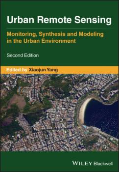
Urban Remote Sensing
The second edition of Urban Remote Sensing is a state-of-the-art review of the latest progress in the subject. The text examines how evolving innovations in remote sensing allow to deliver the critical information on cities in a timely and cost-effective way to support various urban management activities and the scientific research on urban morphology, socio-environmental dynamics, and sustainability. Chapters are written by leading scholars from a variety of disciplines including remote sensing, GIS, geography, urban planning, environmental science, and sustainability science, with case studies predominately drawn from North America and Europe. A review of the essential and emerging research areas in urban remote sensing including sensors, techniques, and applications, especially some critical issues that are shifting the directions in urban remote sensing research. Illustrated in full color throughout, including numerous relevant case studies and extensive discussions of important concepts and cutting-edge technologies to enable clearer understanding for non-technical audiences. Urban Remote Sensing, Second Edition will be of particular interest to upper-division undergraduate and graduate students, researchers and professionals working in the fields of remote sensing, geospatial information, and urban & environmental planning.
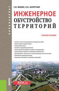
Инженерное обустройство территорий. (Бакалавриат). Учебное пособие.
Города и поселки строятся на площади, которую характеризуют определенные условия: рельеф, уровень грунтовых вод, возможность затопления паводковыми водами и т.д. Средства инженерного обустройства позволяют сделать территорию площади наиболее пригодной для строительства и эксплуатации архитектурных сооружений. В учебном пособии рассматриваются способы и технологии инженерного обустройства территорий: мелиоративные работы, орошение, рекультивация земель, агролесомелиорация, защитное лесоразведение, озеленение, строительство дорог и др. Соответствует ФГОС ВО последнего поколения. Для студентов, обучающихся по направлению подготовки «Земле-устройство и кадастры», а также слушателей курсов повышения квалификации в сфере управления имущественным комплексом.
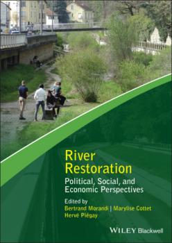
River Restoration
River Restoration River restoration initiatives are now widespread across the world. The research efforts undertaken to support them are increasingly interdisciplinary, focusing on ecological, chemical, physical as well as societal issues. River Restoration: Political, Social, and Economic Perspectives provides a comprehensive overview of research in the field of river restoration in humanities and the social sciences. It illustrates how, in the last thirty years or so, such approaches have evolved and strengthened within the restoration sciences. The scientific community working in this domain has structured itself, often regionally and circumstantially, to critically assess and improve restoration policies and practices. As a research field, river restoration tackles three thematic axes: Human-river interactions – especially perceptions and practices of rivers, and how these interactions can be changed by restoration projects Political processes, with a particular interest in governance and decision-making, and a specific emphasis on the question of public participation in restoration projects Evaluation of the social and economic benefits of river restoration River Restoration: Political, Social, and Economic Perspectives encompasses these three topics, and more, to provide the reader with the most up-to-date and holistic view of this constantly evolving area. The book will be of particular interest to human and social scientists, biophysical scientists (hydrologists, geomorphologists, ecologists), environmental scientists, public policy makers, design or planning officers, and anyone working in the field of river restoration.
Докембрийские комплексы фундамента палеозойской островодужной системы на Среднем Урале. (Аспирантура). (Магистратура). Монография
Книга посвящена характеристике неопротерозойских магматических и метаморфических комплексов, залегающих среди палеозойских островодужных образований на Среднем Урале. Геохимические данные свидетельствуют о формировании докембрийских комплексов в результате субдукционных, плюмовых и аккреционных процессов, без заметного участия континентальной коры. Книга будет интересна для специалистов по региональной геологии, петрологии магматических и метаморфических комплексов, а также студентов геологических специальностей. Ключевые слова: Урал, островная дуга, Палеозой, докембрийский фундамент, метаморфизм, магматизм.
Отражательная способность и цвет почв. (Аспирантура, Бакалавриат, Магистратура, СПО). Учебное пособие.
Учебное пособие предназначено для студентов факультета почвоведения Московского государственного университета имени М.В.Ломоносова, обучающихся по направлениям «Почвоведение», «Экология и природопользование». Пособие посвящено анализу теоретических основ формирования спектральной отражательной способности и окраски почв, возможностям и проблемам практического применения спектральных показателей. Рассмотрена природа влияния электромагнитных излучений на энергетическое состояние атомов и молекул веществ, составляющих почвенные компоненты. Представлены механизмы формирования и основы теории цветности органических и неорганических соединений. Описаны способы измерения и выражения цвета в различных колориметрических системах, в том числе Манселла, RGB, XYZ, CIELAB. Проанализированы роль и количественный вклад процессов пропускания, поглощения, рассеяния и отражения света в общий энергетический баланс почвы. Обсуждены показатели, применяемые для оценки отражения, пропускания и поглощения света почвами и их компонентами. Особое внимание уделено рассмотрению связи спектров отражения с концепцией цветовых пространств. Рассмотрено влияние вещественного состава и физического состояния почв на отражательную способность и цвет почв, описаны закономерности формирования отражательной способности почв разных генетических типов, опыт применения показателей цвета международной системы CIELAB для диагностики типовой принадлежности почв. Обсуждены возможности применения показателей спектральной отражательной способности почв в дистанционных методах исследований, в том числе для оценки содержания гумуса, диагностики нефтезагрязнения, степени эродированности и степени засоления почв. Данное пособие может быть полезно научным работникам, специалистам в области охраны природы и экологического прогнозирования, студентам, аспирантам, стажерам университетов и вузов по специальностям: почвоведение, экология, география, геология


