Книги о Путешествиях
Различные книги в жанре Книги о ПутешествияхCycling the Canal du Midi

This guidebook describes a 240km cycle ride along the length of the Canal du Midi in southern France. Starting at Toulouse in the Haute Garonne and finishing at Sète on the Mediterranean Coast, the route is divided into five stages of about 50km. It is a flat, car-free and picturesque route mainly on the towpath, and is suitable for all abilities. The guide is written for those who want to explore the canal and visit attractions along the way. There are lots of optional detours to sites of interest near the canal, as well as six longer excursions including fortified Carcassone, Roman Narbonne, Vendres lagoon and the Portiragnes marshes. Detailed route descriptions are crammed with additional information about points of interest passed, and 1:200,000 scale maps clearly show the route for each stage of the way. Begun in 1666 the Canal du Midi is one of the world's most picturesque waterways and a World Heritage Site. This is 'La France Profonde', a region rich in history and culture, as seen in the grand homes and chateaux that grace the water's edge, and the fascinating Cathar strongholds of Carcassone, Lastours and Minerve.
Walking in the Yorkshire Dales: South and West

A guidebook to 44 circular walks in the south and west of the Yorkshire Dales National Park, with bases including Sedbergh, Malham, Grassington, Skipton, Settle and Kirkby Lonsdale. The walks cover the valleys of Wharfedale, Littondale, Malhamdale, Ribblesdale and Dentdale – each with its own distinctive landscape and character. Also included is the Yorkshire Three Peaks, a 23 mile (37km) challenge to bag three summits – Pen-y-ghent, Whernside and Ingleborough.
The walks range between 3.5 and 13 miles in length and showcase Yorkshire's diverse landscapes, beautiful views and rich heritage. With the exception of the Three Peaks walk, they are designed to suit most abilities: steeper sections are rare and usually short-lived. Detailed route description and 1:50,000 OS mapping are provided for each route, along with information on nearby points of interest and facilities.
Highlights include delightful riverside walking in Wharfedale, spectacular views of the distant Howgills and Lake District Fells, and the arresting limestone cliffs of Malham Cove providing a wonderful introduction to this magnificent area.
Walking in the Drakensberg

A guidebook to the Maloti-Drakensberg Park World Heritage Site. The book describes 75 day walks of between 1km and 26km long, in Royal Natal National Park, Cathedral Peak, Monk's Cowl, Injisuthi, Giant's Castle, Highmoor, Kamberg, Lotheni, the Himeville and Underberg districts, plus Bushman's Nek. Graded from easy to strenuous, the walks take in the spectacular natural beauty of the area.
Written by a qualified Safari Guide, this book covers 11 areas of the Maloti-Drakensberg Park. It combines clear route descriptions and maps with inspirational photographs, alongside lots of information about local wildlife and the facilities available in each area covered.
This range of huge peaks, towering basalt cliffs, massive sandstone outcrops and deep gorges forms the core of an area of unlimited potential for walkers, until recently little known outside South Africa. The area has a unique geological structure and a fascinating history as well as a large variety of antelope and other mammals and a regular bird list of over 200 species.
Trail and Fell Running in the Lake District

The 40 routes in this guidebook offer some of the best trail running, fell running and sky running routes in the Lake District National Park, one of the world's great mountain running regions. Each route has been carefully graded to indicate terrain and difficulty so that the runner can select a route that suits their ability or aspirations for the day. Routes range from 5 miles to 21 miles, and include classics such as the Helvellyn skyline, Langdale Horseshoe, Borrowdale and Scafell Pike direct.
Detailed route descriptions and OS map extracts accompany each route, along with key facts, including distance, ascent, descent, timings, maps, transport and parking. There is a useful introduction explaining the history of trail and fell running in the Lake District, along with advice about the best bases for a trail running holiday, equipment and adapting to running off road.
There is a rich history of mountain running in the UK, and for many the Lake District is the spiritual home of fell running. Whether you want to follow the course of some of the classic fell races, or explore some of the quieter corners of the national park, the aim of this book is to inspire you to enjoy this thrilling sport in one of its greatest playgrounds.
Trekking in Mallorca
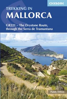
This guidebook describes the GR221, a 140km (87 mile) long-distance trail through northwestern Mallorca, from Port d'Andratx to Pollença. Also known as the 'Ruta de Pedra en Sec' ('the Drystone Route'), the GR221 is a celebration of Mallorca's limestone heritage, taking in many historic drystone structures as it traverses the rocky peaks of the Serra de Tramuntana. Following old stone-paved paths and mule trails, it showcases the region's beautiful landscape of mountains, forests and cultivated terraces, as well as its spectacular coastline.
The GR221 can be walked in 1-2 weeks, although the guide also covers 3 alternative start-points and 3 alternative finishes, which would allow for a shorter trek. The main route is presented in 10 stages of 8.5-20.5km (5-13 miles), with a handful of optional detours to bag neighbouring summits. Detailed route description is accompanied by 1:25,000 mapping and inspirational photography, plus a wealth of information on local points of interest. Accommodation and travel are also thoroughly covered: the trail boasts good transport links and plentiful facilities on route, with accommodation in welcoming mountain villages and the occasional 'refugi'. A comprehensive introduction offers the opportunity to discover more about the region's diverse plants and wildlife and unique history and culture, and an English-Spanish-Catalan glossary can be found in the appendix.
With a favourable climate and stunning scenery, the Serra de Tramuntana has much to tempt the walker. The GR221 Drystone Route represents an ideal way to explore this fascinating World Heritage Site.
The Loire Cycle Route

The 1052km Loire cycle route starts at the source of the Loire in the Massif Central mountains of central France and finishes at the Atlantic opposite St Nazaire. It descends past extinct volcanoes, crater lakes and deep gorges before joining EuroVelo route 6 and the fully waymarked Loire a Velo, France's most popular cycle trail.
Following the river downstream in 26 stages, the route is generally downhill or level often on dedicated traffic-free cycle tracks. Packed with a wealth of useful information – from practical planning advice to fascinating insights about the river and its surroundings – the guidebook features detailed route descriptions and informative mapping. Details of facilities and places to stay, and a French glossary are included.
The route goes through the heart of France as the Loire becomes the royal river, bounded by extravagant chateaux, fields of Charolais cattle and vineyards. It passes through historic cities like Orleans and Tours, continuing past Angers and France's fourth largest city Nantes.
The GR5 Trail - Vosges and Jura

Guidebook to a principal north-south long-distance walking route through eastern France, traversing the Vosges and the Haut-Jura plateau along the GR5/GR53. The 687km (427-mile) waymarked path traverses the entire length of the Vosges, and then climbs up onto the plateau of the Haut-Jura before dropping down to Nyon on the shores of Lake Geneva. The GR5 is one of the great walking routes across Europe, crossing the continent from the Dutch coast to the Mediterranean, and the route described here is the central section (518km) from Schirmeck down to Lake Geneva. In addition, the GR53 in the Northern Vosges from Wissembourg to Schirmeck (169km) is described as an offshoot of the GR5 that allows walkers to complete the entire chain of the Vosges.
The route is presented in 11 chapters, which in turn are broken into short sections of a few hours each, allowing for a flexible itinerary and easy route planning. There are also suggestions for shorter circular routes making use of sections of the GR53/GR5, as well as an overview of other long-distance routes in the region. A summary of local history, plants and wildlife and delicacies can be found in the introduction and appendices offer details of facilities on route and full accommodation listings.
Two further Cicerone guidebooks cover the remaining sections of the GR5; 'The GR5 Trail – Benelux and Lorraine', and 'The GR5 Trail' which covers the route from Lac Léman to the Mediterranean.
Suffolk Coast and Heath Walks

The three long-distance walks described in this book – the Suffolk Coast Path, the Stour and Orwell Walk and the Sandlings Walk – link together to provide a comprehensive and varied circuit of the entire Suffolk Heritage Coast.
The Suffolk Coast Path stretches along the coast between Lowestoft and Landguard Fort, close to Felixstowe in the south, a total distance of 60 miles (97km) depending on whether beach walking or inland options are followed. The Stour and Orwell Walk continues where the Suffolk Coast Path ends, starting at Landguard Point threading for 40 mile (64km) around the estuaries of the Stour and Orwell rivers to finish at Cattawade, close to the Essex border. The Sandlings Walk (59 miles/94.5km) explores the heathland region that lies immediately inland from the Suffolk coast. With the exception of the first stage, between Ipswich and Woodbridge, the route of the Sandlings Walk lies entirely within the confines of the Suffolk Coast & Heaths AONB. With a unique landscape of cliffs, marshes, dunes and shingle beaches, and rare plants and birdlife galore, there is much to attract anyone seeking interesting day walks or longer multi-day itineraries.
The Lancashire Cycleway

The 265 mile (425km) Lancashire Cycleway showcases the idyllic scenery of England's historic Red Rose County. Comprising of two distinct loops that intersect at Whalley in the Ribble Valley, the Northern Loop contrasts the quiet lanes and peaceful countryside of northwestern Lancashire with the thrill of the open moors of the Forest of Bowland AONB; the Southern weaves its way between the villages and towns in the south of the county, an area rich in social history.
Easily accessible from the region's rail network, the route – which is all on-road – can be cycled either as a tour or a series of day rides. This guidebook presents the Lancashire Cycleway in 11 stages of 16.5 – 30.9 miles (26.6 – 49.7km), plus two short connections to link the loops to the major regional stations at Lancaster and Wigan, as well as 17 varied day rides for those wishing to explore the county further.
Detailed route description and 1:100,000 mapping is presented alongside a wealth of information on local points of interest and facilities, and the magnificent colour photography offers a small taste of what the routes have to offer. The guide also includes useful advice for those new to cycling or cycle touring.
The Speyside Way

This guidebook describes the Speyside Way, an official 66 mile (106km) Scottish Great Trail route which follows the River Spey through northern Scotland from Aviemore to the old port of Buckie on the Moray coast. Featuring easy walking on good paths and along disused railway lines, the route can be comfortably completed in a week and is presented in 10 stages of between 2 and 13 miles (3-21km).
The guide also details the recently opened 6½-mile (10.5km) extension to the Speyside Way between Kincraig and Aviemore as well as two alternatives to the main route and routes to the source of the Spey. Also featured are three other trails in the same region which can be combined with the Speyside Way to form a longer trek: the 25 mile (40km) Dava Way, 47 mile (76km) Moray Coast Trail and 12½ mile (20km) Badenoch Way.
Alongside detailed route description, the guide includes background information, local points of interest (including a list of distilleries), tips on transport and accommodation and recommendations for mountain-bikers and riders, who can follow stretches of the route.
The guidebook comes with a separate map booklet of 1:25,000 scale OS maps showing the full route of the Speyside Way. Clear step-by-step route descriptions in the guide links together with the map booklet at each stage along the Way, and the compact format is conveniently sized for slipping into a jacket pocket or the top of a rucksack.