Craig Romano
Список книг автора Craig RomanoDay Hiking Mount St. Helens
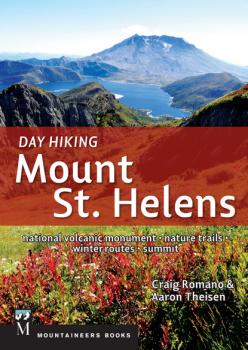
*CLICK HERE to download sample hikes from Day Hiking Mount St. Helens* 80 day-hiking routes, summit routes, camping options, and more General details on visitors’ centers and nature trails along each of the four major Monument access roads Popular winter trails also included Whether you just want to stretch your legs on a short interpretive trail near the visitors’ center or you’re looking for an uncrowded backcountry route on the side of an active volcano, Day Hiking: Mount St. Helens will help you select the adventure you’re looking for. This addition to the popular «Day Hiking» series includes a new feature: hikes of less than 3 miles—nature and interpretive trails—that are featured in short write-ups, without a point by point description or map. They are a bonus to the meat of this collection of the best trails on Mount St. Helens and in the surrounding forests. The guide also includes photos, maps, descriptions, and driving directions to all the longer trails, indicating those with camping sites and opportunities to link hikes for multi-day adventures. The book is organized according to the mountain’s aspects—east side, west side, south side, or north side, which is how many people explore it. **Mountaineers Books designates 1 percent of the sales of select guidebooks in our Day Hiking series toward volunteer trail maintenance. For this book, our 1 percent of sales is going to Washington Trails Association (WTA) . WTA hosts more than 750 work parties throughout Washington’s Cascades and Olympics each year, with volunteers clearing downed logs after spring snowmelt, cutting away brush, retreading worn stretches of trail, and building bridges and turnpikes. Their efforts are essential to the land managers who maintain thousands of acres on shoestring budgets.
Day Hiking: The San Juans & Gulf Islands
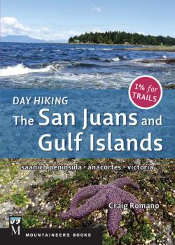
Packable size filled with maps, elevation profiles, 130 photos, at-a-glance trail selection table, and more from a beloved trails author 1% of sales support trail maintenance in Washington As a hiking destination, the San Juan Islands of Washington and their sister islands to the north offer scores of parks and preserves, hundreds of miles of trails catering to hikers of all levels, and year-round accessibility. Day Hiking: The San Juans and Gulf Islands is divided into roughly four sections: Anacortes, for many the gateway to the region; the San Juan Islands themselves, including some key islands not served by Washington State Ferries; Victoria, Canada, providing easy access to the Gulf Islands, as well as other unique destinations; and the magical southern Gulf Islands. Author Craig Romano explores state parks, county parks, and provincial parks as well as some municipal and regional parks. He also features the recent expansion of San Juan Island National Historic Park on San Juan Island and the recently created Gulf Islands National Park Reserve, spanning several of the southern Gulf Islands, both of which are not yet familiar to many hikers. While the star attractions are the ferry-accessed islands, Romano also features several of the larger islands that don’t have ferry service (e.g., Stuart Island)——making this guide of interest to paddlers and boaters who are looking for hikes too! Key features of this guide: 136 hikes (approximately 50% American, 50% Canadian locations) Ferry travel tipsCar-camping recommendations Border-crossing details All distances and elevations in both English and metric units Overview maps for both the San Juans and Gulf Islands **Mountaineers Books designates 1 percent of the sales of select guidebooks in our Day Hiking series toward volunteer trail maintenance. For this book, our 1 percent of sales is going to Washington Trails Association (WTA) . WTA hosts more than 750 work parties throughout Washington’s Cascades and Olympics each year, with volunteers clearing downed logs after spring snowmelt, cutting away brush, retreading worn stretches of trail, and building bridges and turnpikes. Their efforts are essential to the land managers who maintain thousands of acres on shoestring budgets.
Day Hiking Eastern Washington
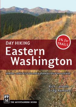
CLICK HERE to download the 5 out of 5 star rated hike, «Thirteen Mile Mountain» (not actually 13 miles long!) from Day Hiking Eastern Washington (Provide us with a little information and we'll send your download directly to your inbox) One of the comprehensive regional editions in the popular «Day Hiking series»[/i] for Washington State 1% of sales are donated to trail maintenance Offers many close-to-home trails near population centers like Spokane, Tri-Cities, Ellensburg, and Yakima Day Hiking: Eastern Washington features 125 day hikes throughout the eastern Washington region, roughly covering the area of the state east of Highway 97. This expansive region includes the Spokane area, Colville National Forest and northeastern Washington (Colville, Metaline Falls, Kettle Falls, Republic, Tonasket), Moses Lake, Soap Lake, Coulee Dam, Lake Roosevelt, and other parts of the mid- and upper-Columbia River basin, southeast Washington (Pullman, the Blue Mountains, Walla Walla, Tri-Cities), and the eastern reaches of the Columbia River. Who better to cover such a large geographic area than long-time eastern Washington expert Rich Landers, partnered with Day Hiking guru Craig Romano? These two trekkers have combined forces to research and write an authoritative guide that is sure to become the new gold standard. **Mountaineers Books designates 1 percent of the sales of select guidebooks in our Day Hiking series toward volunteer trail maintenance. For this book, our 1 percent of sales is going to Washington Trails Association (WTA) . WTA hosts more than 750 work parties throughout Washington’s Cascades and Olympics each year, with volunteers clearing downed logs after spring snowmelt, cutting away brush, retreading worn stretches of trail, and building bridges and turnpikes. Their efforts are essential to the land managers who maintain thousands of acres on shoestring budgets.
Day Hiking Columbia River Gorge
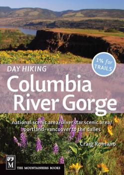
**UPDATE** We have a correction regarding Hike #39, Grassy Knoll and Big Huckleberry Mountain (page 137) To download the updated driving directions for the trailhead please click HERE CLICK HERE to download the «Hardy Ridge» hike as well as the hike up «Mount Defiance» from Day Hiking Columbia River Gorge The Columbia River Gorge National Scenic Area is the single biggest visitor destination in Oregon 25 of these hikes are published here for the first time Caters to the greater Portland, Oregon–Vancouver, Washington metro area The Columbia River Gorge forms much of the long border between Washington and Oregon, offering hikers a multitude of beautiful trails. Famous for its cascading waterfalls, the region offers spectacular views of the mighty river and its windswept bluffs, as well as stunning panoramas of the surrounding landscape and peaks including Mount Hood, Mount St. Helens, Mount Adams, and the Sisters. Day Hiking Columbia River Gorge , by well-known hiking author Craig Romano , features: 100 day hikes on both sides of the river extensive year-round hiking options trails in the National Scenic Area, Silver Star Scenic Area, Trapper Creek, Clark County, and beyond easy-to-read icons for waterfalls, views, dog-friendly trails, and more detailed driving directions and trail maps info on flora and fauna, the unusual Gorge winds, and its abundance of waterfalls Learn more about author Craig Romano at his website or connect with him one step further by «liking» his page on Facebook. **Mountaineers Books designates 1 percent of the sales of select guidebooks in our Day Hiking series toward volunteer trail maintenance. . For this book, our 1 percent of sales is going to Washington Trails Association (WTA) . WTA hosts more than 750 work parties throughout Washington’s Cascades and Olympics each year, with volunteers clearing downed logs after spring snowmelt, cutting away brush, retreading worn stretches of trail, and building bridges and turnpikes. Their efforts are essential to the land managers who maintain thousands of acres on shoestring budgets.
Backpacking Washington

Proceeds will support trail maintenance in Washington Features weekend backpacking trips, with info on how to extend most routes Guidebook covers the entire state of Washington Veteran guidebook author Craig Romano hits the trail again——this time to uncover amazing backpacking opportunities all over Washington’s wilderness. Backpacking Washington details 70 routes, from the lush Hoh River Glacier Meadows to the open ridges of the Columbia Highlands and beyond. With an emphasis on weekend trips, routes range from overnight to weeklong treks and often include options for extending trips or choosing camp spots. Features: detailed route descriptions and trail maps mileage logs with campgrounds, water, and other trail elements icons for choosing family- and dog-friendly trips recommended nearby day hikes info on the state’s three long-distance trails: Pacific Crest Trail, Pacific Northwest Trail, and Wonderland Trail
Day Hiking Central Cascades
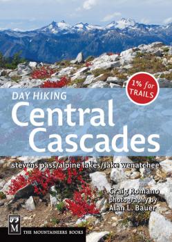
CLICK HERE to download three sample hikes from Day Hiking Central Cascades 125 trails, each rated on an overall-quality scale of 1 to 5 Full-color photo insert and overview map 1% of sales donated to the Washington Trails Association for trail maintenance The Central Cascades offer some of the most accessible wilderness areas for urban Seattleites, with trails no less stunning or enjoyable than those in more remote regions. Day Hiking Central Cascades includes 50% more hikes than other regional guidebooks and focuses on cream-of-the-crop trails in these areas: Whidbey Island; Skykomish, Wenatchee, and Icicle River Valleys; the Entiat Mountains; the Lake Chelan area; and more. Compact in size, this is the most up-to-date guide for the area, organized along highways and other travel corridors, and with an emphasis on trails that are 12 miles or less, round-trip, each of them hiked by the author. **Mountaineers Books designates 1 percent of the sales of select guidebooks in our Day Hiking series toward volunteer trail maintenance. For this book, our 1 percent of sales is going to Washington Trails Association (WTA) . WTA hosts more than 750 work parties throughout Washington’s Cascades and Olympics each year, with volunteers clearing downed logs after spring snowmelt, cutting away brush, retreading worn stretches of trail, and building bridges and turnpikes. Their efforts are essential to the land managers who maintain thousands of acres on shoestring budgets.
Day Hiking North Cascades
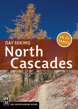
CLICK HERE TO DOWNLOAD THE LOOP HIKE, «FRAGRANCE LAKE» CLICK HERE to download two free hikes from Day Hiking North Cascades 125 trails, each rated on an overall-quality scale of 1 to 5 Quick-reference icons for kids, dogs, views, and more Full-color photo insert and overview map 1% of sales donated to the Washington Trails Association «Romano is one of the better guidebook writers around… He covers a lot of territory that other guidebooks have passed up.»– Seattle Post-Intelligencer Discover the stunning scenery that abounds in the North Cascades region, where hikers indulge in the drama of steep peaks, deep valleys, and everything in between. This new guide covers the Bellingham area, Mount Baker, the Highway 20 corridor, North Cascades National Park, Winthrop and the Pasayten Wilderness area, parts of Glacier Peak Wilderness, and the Mountain Loop Highway. Compact and fresh with a broad range of hiking options, this is the most up-to-date guide for the area, organized along highway and other travel corridors with an emphasis on trails that are 12 miles or less, round-trip. Check out Craig Romano's blog:http://worldhiker.blogspot.com/ [i]**Mountaineers Books designates 1 percent of the sales of select guidebooks in our Day Hiking series toward volunteer trail maintenance.
Day Hiking North Cascades
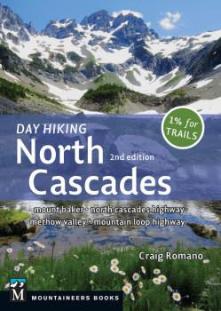
This guide covers Mount Baker, the North Cascades Highway (SR 20) corridor, North Cascades National Park, Winthrop and the Methow Valley, the Pasayten Wilderness area, parts of Glacier Peak Wilderness, and the Mountain Loop Highway. Compact and fresh with a broad range of hiking options, this is the most up-to-date guide for the area, and is organized along highway and other travel corridors with an emphasis on trails that are 12 miles or shorter, round-trip. The new edition features 136 hikes total, with 30 all-new ones and several expanded routes. Many of these hikes are not included in any other guide.