Terry Marsh
Список книг автора Terry MarshThe Severn Way

This guidebook offers all the information walkers need to enjoy the 338km (210 miles) of the Severn Way. Beginning at the River Severn's source in Powys, mid-Wales, the route follows the entire Severn Valley, meandering through many superb landscapes and interesting towns and villages before finishing near Bristol, in south-west England.
The step-by-step route description is divided into four county sections, accompanied by OS map extracts and packed with historical and geographical information about the places along the way. Also includes a route to the source of the river via Plynlimon and a link route from Severn Beach back to Bristol at the end.
The River Severn pulls together threads of history, trade, commerce, civil war and the lives of ordinary folk to produce a tapestry that is finely woven and rich in colour. That walkers should want to trace its course, its many twists and turns, is hardly surprising, not least because of its capacity to offer countless challenges and plentiful delights. Walking the Severn Way is a chance to get away from it all and relax without having to resort to distant mountain regions.
Geocaching in the UK
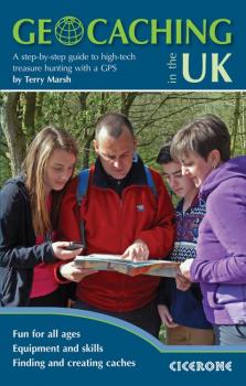
Geocaching is high-tech treasure hunting using a GPS, and this is the first UK-oriented guide to this most addictive of outdoor pursuits. For first-timers and for experienced geocachers, this step-by-step guide tells you all you need to know to get started – from understanding GPS devices, to finding caches, recording your discoveries and setting up your own caches. For those bitten by the geocaching bug, a different kind of treasure is all around, just waiting to be found. And there are accurate and detailed clues out there to help you find it. The fun lies in the challenge: deciphering clues, downloading co-ordinates, mastering your GPS device, and then setting off into the countryside in search of artfully-concealed caches. Since it began in the year 2000, geocaching has become an international craze, adding a whole new dimension to exploring the outdoors, on your own, with friends and family or at the big events.
The West Highland Way

A guidebook to Scotland's West Highland Way, a 95-mile walk from Milngavie near Glasgow to Fort William, passing Loch Lomond, crossing Rannoch Moor and finishing in the shadow of Britain's highest mountain. The walk, which takes roughly one week to complete, is described in seven stages, with each stage ranging from 8 to 20 miles. The guide details the 'classic' south-north direction but also provides a summary description for those wanting to walk the route in the opposite direction. The guidebook, which features step-by-step route descriptions, 1:100K mapping, handy practical information as well as notes on the region's history, culture and geography, is accompanied by a separate, pocket-sized 1:25K OS map booklet, providing all the mapping you need to walk the route. Passing from the lowlands to the highlands, the West Highland Way, which is one of Scotland's Great Trails, showcases the splendour of glens flanked by great mountains, majestic moorland and sprawling farmland. It is the perfect adventure for distance walkers keen to discover the wild beauty of western Scotland.
The Dales Way

A fully waymarked trail from Ilkley to Bowness-on-Windermere, the Dales Way links two of England's most celebrated national parks, the Yorkshire Dales and the Lake District. Well served for accommodation and facilities, and with easy walking on riverside paths, it is one of the gentlest multi-day walks in Britain and therefore an ideal introduction to long-distance walking. It can be comfortably completed in 6-8 days.
Presented in six daily stages of 7-19 miles (with suggestions for alternative schedules), this guide describes the Way in both directions, with the main route description running from south to north. Step-by-step route description is accompanied by 1:100,000 mapping, and a trek planner, showing where facilities are available, is included to facilitate planning. Accommodation listings and useful contacts can be found in the appendices. A separate, conveniently sized map booklet located in the back-cover sleeve provides all the OS 1:25,000 mapping needed to complete the trail.
The guide offers comprehensive notes on local points of interest, as well as an overview of Dales geology, history, plants and wildlife to enhance the walking experience. The practical information is all there too, including when to go, how to get there and what to take, making for an ideal companion to enjoying this delightful route.
The Isle of Mull

A comprehensive walking guide to the Isle of Mull. The 47 routes described range from 3 to 14 miles long and from short circuits to demanding mountain traverses, but there are few technical difficulties and experienced, properly equipped walkers will find them hugely rewarding.
The book includes walks on the neighbouring islands of Ulva, Gometra, Iona and Erraid, and is also full of information about all the islands' history and their much-studied and endlessly fascinating geology and will appeal to those who know Mull well as much as those who are discovering it for the first time.
Step by step route description is accompanied by OS mapping and information on local points of interest. The Isle of Mull is easily accessible from Oban on the west coast of Scotland and will appeal to walkers seeking secluded routes, with inspiring views around almost every corner.
Mull boasts wild, rugged scenery and a spectacular coastline, as well as outstanding opportunities for observing wildlife, including deer, otters, golden and sea eagles, dolphins and harbour porpoise.

Walking on the Isle of Man

40 walks on the coast, fells and inland valleys of the Isle of Man are explored in this guidebook. Most of the walks are short and accessible for walkers of all abilities, however for a greater challenge, many of the routes (between 2 and 22km) can be combined. The Isle of Man offers the walker a wonderfully diverse range of landscapes within a relatively compact island setting, and the routes reflect this diversity – scale the highest point Snaefell (620m), cross wide open moorlands, drift over beaches and climb coastal clifftops. The assortment provides walkers with fantastic trails, along with detail on the wildlife, wild flowers, unique history and points of interest encountered. Alongside detailed route descriptions and OS maps, there is plenty of practical information on getting to and around the Manx Isle and advice on making the most out of any exploration of the Isle of Man.
Walking in the Forest of Bowland and Pendle

A guidebook to 40 circular walks in in two of Lancashire's largest Areas of Outstanding Natural Beauty – the Forest of Bowland, an area of 310 square miles, and the 'bewitching' countryside of Pendle to the south. The walks range between 3 and 12.5 miles in length and are all illustrated with extracts of OS mapping.
The diverse range of routes include four Marilyns – Ward's Stone, Pendle Hill, Longridge Fell and Fair Snape Fell. The walks are spread across the region, with bases including Caton, Dunsop Bridge, Slaidburn, Clitheroe and Pendle. All the walks are punctuated with snippets of information on the natural and cultural history of the region, from witches to wildlflowers.
The Forest of Bowland and Pendle provide vastly differing terrain – from the lush farmlands of the Ribble valley to the more rugged rough pastures of the Forest of Bowland uplands and the huge boggy uplifts of the main Bowland massif itself.
Great Mountain Days in the Pennines
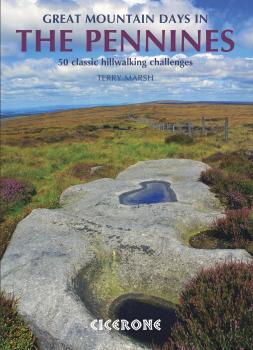
An inspirational guidebook to 50 great walks throughout the Pennines. A wide range of routes in this larger format book have been selected to help walkers explore all aspects of this beautiful upland area. The walks are all graded, from moderate to strenuous, and are between 6 and 13 miles long, with plenty of options for both first-time and more experienced walkers. Ranging between the North Pennines, Howgills, Yorkshire Dales, South Pennines and Dark Peak, this guide offers the best of the mass of fell and moor that makes up the backbone of England. Routes include Cross Fell, Wild Boar Fell, Ingleborough, Whernside, Pen-y-Ghent, Pendle Hill, Kinder Downfall and a traverse of Ilkley Moor and many are suitable for fell running. The circular walks are all graded, making this guidebook equally suitable for first-time and more experienced walkers looking to explore new corners of the Pennines. All routes are illustrated with 1:40,000 OS mapping and plenty of colour photography.
Great Mountain Days in Snowdonia

A guidebook to 40 great mountain walks and scrambles in Snowdonia. The inspirational routes in this larger format book range right across the Snowdonia National Park and are divided into 8 geographical regions: Snowdon and Moel Eilio, the Glyderau, the Carneddau, Eifionydd, Siabod and the Moelwynion, Rhinogydd (the Harlech Dome), Migneint and the Arans and Cadair Idris and the Tarrens.
All routes are graded, from moderate to strenuous, and illustrated with Harvey map extracts, topo diagrams by Mark Richards and lots of stunning photographs. Some routes include mild scrambling or long days in rugged country, and many can be enjoyed all year round. The walks have been chosen to encourage you to try something new in this much-loved region, while at the same time offering clear descriptions of classic routes for those new to Snowdonia.